Soudelor was strong Category 3
No tornadoes but there were ‘pockets’ of Category 4 winds
A month after Typhoon Soudelor made landfall on Saipan, the National Weather Service in Guam along with the University of Guam released yesterday the partial results of their assessment of how strong the typhoon really was.
NWS issued their determination of the “over-water” intensity of Typhoon Soudelor as it passed across Saipan and the maximum winds likely experienced on the island.
NWS identified Soudelor as a strong Category 3 typhoon according to the Saffir-Simpson scale and acknowledged that it had an intensity stronger than predicted as it made a direct hit on the island on Aug. 2.
“Based on the assessment of all available meteorological information, the best estimate of the maximum ‘over-water’ wind in Typhoon Soudelor as it passed over Saipan was 110 knots with gusts to 130 knots or 127 miles per hour with gusts to 150 miles per hour,” said Dr. Mark Lander, meteorologist at UOG’s Water and Environmental Research Institute.
Prior to landfall, Soudelor was forecasted only as a Category 2 typhoon. An update of 105 miles per hour maximum winds and 120 miles per hour gusts was issued by NWS before it hit the island.
While some residents reported experiencing tornado-like conditions, NWS said there were none.
“There was no evidence of tornadoes on the island, and all heavier damage could be related to topography or wind passing around obstacles such as large concrete buildings,” Lander said.
Pockets of Category 4
NWS said, however, that due to the rugged terrain and other island characteristics, there was significant modification of the “over-water winds.”
“Due to the rugged terrain, there were isolated pockets of Typhoon Category 4 winds, perhaps as high as 150 mph with gusts to 180 mph, especially where the winds rammed directly into cliffs or were funneled through narrow valleys,” said Chip Guard, warning coordination meteorologist of the NWS Forecast Office Guam.
They observed that concrete buildings did fine, but wood and tin buildings made of light or weakened materials were heavily damaged or destroyed.
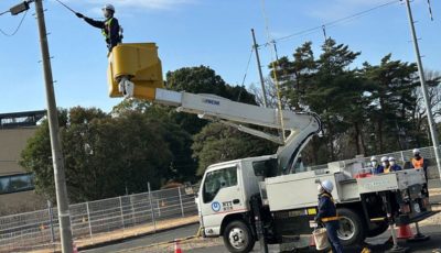
They also noted that the power distribution system was heavily damaged mainly due to the failure of primarily old, weakened power poles.
“Newly emplaced or well-guyed power poles suffered little damage,” Guard said.
Aside from determining the strength of winds, the team also analyzed available weather satellite data, Doppler radar data, and data from a small number of observational instruments.
Guard and Lander, who went to Saipan on Aug. 10 to conduct a scientific assessment of Soudelor’s characteristics, will also be studying other aspects of the cyclone and will be publishing their findings in a more comprehensive technical report in a few months.
“The compact size of Soudelor is something we will be studying in much more detail,” Guard said.
Soudelor was said to be a very small system, with a 5-mile diameter eye, and with typhoon force winds extending no more than 10 miles from the center and tropical storm force wind extending no more than 20 miles from the center.
Due to its small size, NWS said that “no significant inundation was observed, and wave run-up was consistently measured at only 5 feet above high tide at the numerous coastal locations visited” with regards to storm surges.
Also, NWS said that while the storm total rainfall was “not very impressive,” rainfall rates were likely very high at locations where the eye wall passed.
“The team found a deep gully at upper Tank Beach, evidence of a very heavy rainfall event. Mr. Guard and Dr. Lander are still assessing the rainfall amounts and distributions for Saipan,” their report said.
According to their statement, the level of damage, the perceived storm intensity, and the lack of determinant maximum wind measurements led the NWS Pacific Region Headquarters at Pearl Harbor Hawaii to approve a scientific wind assessment on Saipan.
They said these assessments are sometimes conducted when there is some question as to the actual intensity of a destructive typhoon.


