NWS expects no typhoon on Aug. 22
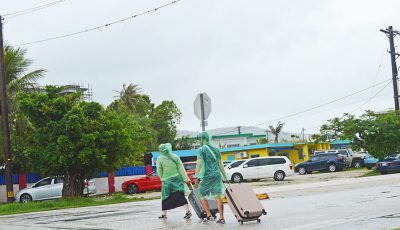
The National Weather Service in Tiyan, Guam, officially shot down speculation of a typhoon hitting the region on Aug. 22, but says that activity within the Marianas vicinity will continue.
According to an NWS statement, the agency has been made aware of speculations of a typhoon is expected to hit the Marianas on Aug. 22, based on a long-term numerical weather forecast model. Fortunately, NWS said that their numerical guidance currently shows no weather threats for Guam and the CNMI.
“That model depicted a tropical cyclone in the area that could have been a threat to the islands around Aug. 22. Numerical models are typically run every six hours, compiling data and observations to provide the best forecast at that time. Subsequent model runs may show a similar long-range forecast, or they may differ significantly. Numerical guidance currently shows no significant weather threats to Guam or the CNMI around Aug. 22,” NWS stated.
NWS said, however, that they are still seeing signs of possible development in the region, especially in the long-range.
“We will see this in model forecasts the next several months as is typical this time of year,” NWS stated.
NWS would like to assure the community that the NWS Guam office operates daily and is watching every disturbance in the region that could be an issue for anyone in Guam, the CNMI, Palau, Federated States of Micronesia, and the Marshall Islands. “If we see there is a significant weather threat to anyone in the region, we will make it known,” NWS added.
NWS’ current forecast shows that local weather is under the influence of a weak circulation located southeast of Guam and it is affecting the entire Marianas. The circulation is not expected to develop significantly within the area.
However, showers and thunderstorms will prevail along the northern periphery of this circulation while a few showers and thunderstorms are expected on Tinian and Saipan, with the bulk of the action seen near and south of Rota.
Surf also remains hazardous along west- and north-facing reefs of Guam and the CNMI. Large swell from a distant Tropical Storm Krosa continues to subside across the region but these swell are still capable of generating hazardous surf of 8 to 10 feet along west- and north-facing exposures. The risk of rip currents remains high and is capable of producing life-threatening rip currents.


