

Previous Story
Mawar on track to hit region
Typhoon response team in place
|
Posted on May 22 2023
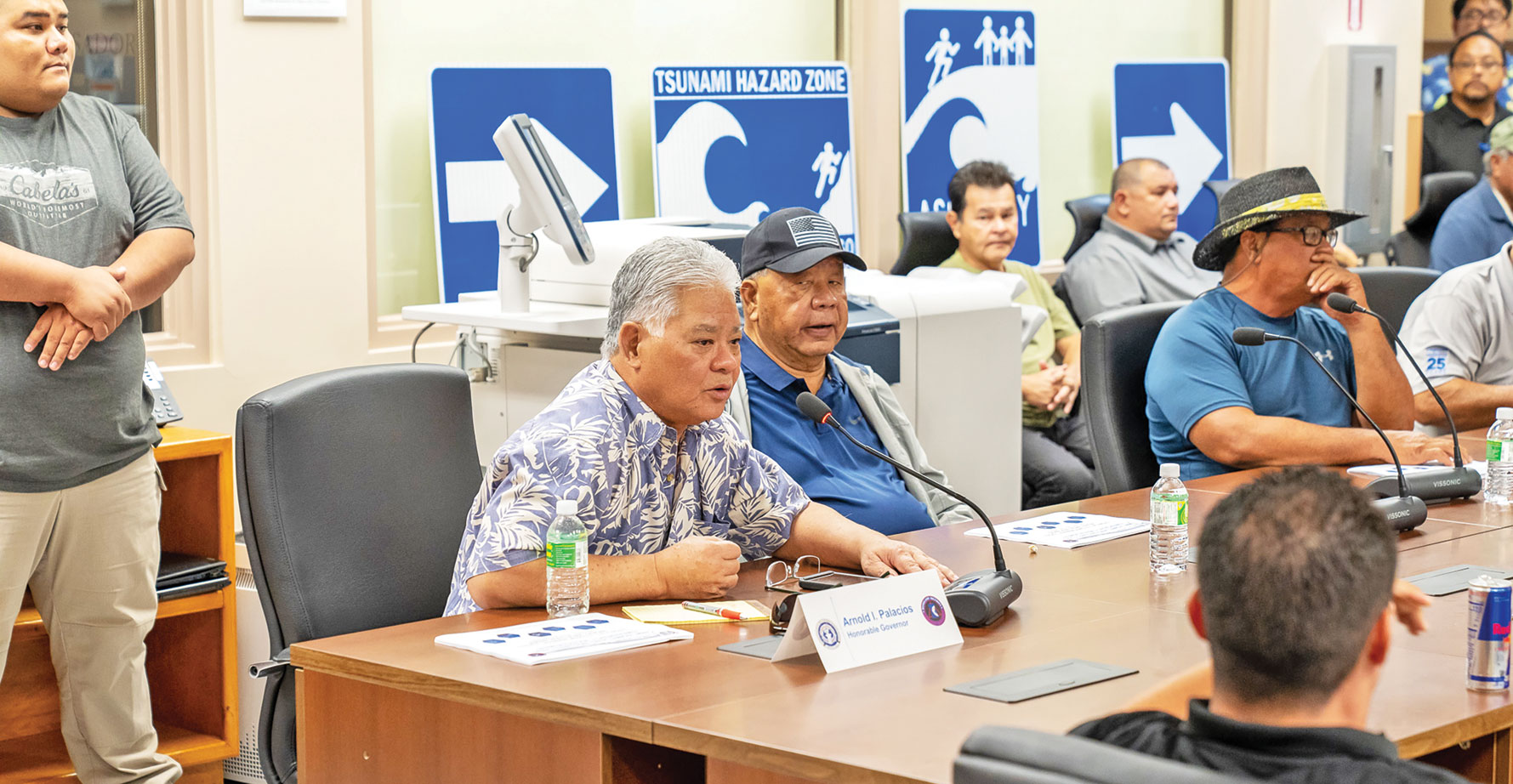
Gov. Arnold I. Palacios, Lt. Gov. David M. Apatang, and the CNMI Multi-Agency Coordination Team, composed of government agencies and other organizations, attend a heavy weather briefing by the National Weather Service Guam at the Homeland Security and Emergency Management office. (OFFICE OF THE GOVERNOR)
A Typhoon Watch remains in effect for the Marianas as Tropical Storm Mawar continues its projected track toward the region in the next couple of days.
Typhoon Condition III has been hoisted over Saipan, Tinian, and Rota since Saturday. This means damaging winds of 39 miles per hour or more are possible today, Monday, and typhoon force winds of 74 mph or greater are possible Monday night through Wednesday.
As of 6pm last night, the center of Tropical Storm Mawar was moving north at 8 mph and is expected to make a slight turn toward the north-northwest with little change in forward speed over the next 24 hours. Maximum sustained winds remain at 60 mph.
Mawar, a name that was contributed by Malaysia and means a rose, is forecast to intensify the next few days, possibly becoming a typhoon later today. It began in the region of the Federated States of Micronesia.
Government preparations
The CNMI administration met with the CNMI Homeland Security and Emergency Management team and the CNMI multi-agency coordination team last Friday morning in preparation for incoming Tropical Storm Mawar.
Last Friday morning, Gov. Arnold I. Palacios and Lt. Gov. David M. Apatang met with HSEM special assistant Franklin R. Babauta and members of the CNMI Multi-Agency Coordination team, which is composed of government agencies and other organizations that will serve as frontliners once Tropical Storm Mawar hits the Marianas this week.
The group met for a heavy weather briefing provided by the National Weather Service in Guam.
In a press conference following the briefing, Babauta said it was important to bring all government and non-government agencies together to form one coordination team to efficiently disseminate information, and also to efficiently provide services should the community need them during the storm and after.
Some of the things discussed during the briefing, said Babauta, were shifts should people be stationed at the HSEM headquarters during the storm, resources available like shelters, and transportation should members of the community need assistance during the storm.
Babauta also shared the importance of efficiently disseminating information at this time, with schools across the CNMI preparing for graduation ceremonies this week.
“We also understand that this week is going to be busy with the school graduations, and we wanted to make sure that we disseminate information efficiently for planning,” he said.
Joey Dela Cruz, HSEM emergency operations manager, stated that all members of the MAC will provide specific emergency support in times like these.
“Members of the MAC team will provide an emergency support function to the state, whether it be transportation, utilities, public safety, medical. We have representation from the state to safeguard our community to cover their areas of responsibility in coordination with the state Emergency Operations Center and in guidance with our incident commander up here,” he said.
Federal Emergency Management Agency representative Brian Beck stated that FEMA will also be monitoring the progress of Tropical Storm Mawar and are currently preparing for the worst while hoping for the best.
“We’ve been tracking the system with NWS since midafternoon on Thursday. Currently, we are not expecting there to be any significant impact to the CNMI right now. However, we are taking preemptive steps to prepare for that. We will just continue to monitor the system and hope for the best while preparing for the worst,” he said.
Public preparations
The office of the Governor, in preparation for anticipated typhoon-strength winds, advises all CNMI residents to take the following preparatory measures:
- Gas vehicles and obtain fuel for your generators.
- Secure loose debris and belongings around your household or yard.
- Those living in flood-prone areas should take action; clear drainage areas and unblock storm drains to minimize flooding.
- Secure important documents such as birth certificates, tax papers, and insurance documents, and keep copies in a weather-proof bag.
- Prepare to board up windows or close shutters.
- Have a prepared emergency preparedness kit with first-aid kits, batteries, flashlights, toiletries, and a portable stove in your household.
- Stock up on food and water, as appropriate, for your household.
- Stay up to date with the latest information from the National Weather Service and the CNMI Office of Homeland Security and Emergency Management and other official sources.


