Previous Story
NOAA research and mapping mission underway to Marianas
The National Oceanic and Atmospheric Administration’s ship Rainier has departed Honolulu, Hawaii, for a major research and mapping campaign in the Marianas. After a two-year delay due to COVID-19, the ship is expected to arrive in Guam in early April and plan to be in the region until August to execute several important projects.
The official title of this research expedition is RICHARD (Rainier Integrates Charting, Hydrography, and Reef Demographics) to honor the late Rear Adm. Richard Brennan, who was the visionary and biggest champion of this collaborative, multi-disciplinary effort designed to meet a suite of science needs in the region.
Onboard, a team of scientists from across NOAA will simultaneously conduct dive-intensive National Coral Reef Monitoring Program long-term coral reef surveys aboard two small boats, and high-resolution seafloor mapping surveys using both the Rainier and two hydrographic survey launches.
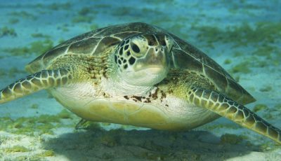
The primary goal of NCRMP is to maintain a long-term time series to report status and trends of U.S. coral reef ecosystems and drivers of ecosystem change. Other important goals of NCRMP are to deliver high-quality data, data products, and tools to the coral reef conservation community, provide context for interpreting results of localized monitoring, and maintain strong partnerships with federal, state/territory, and academic partners.
The high-resolution seafloor mapping surveys will produce bathymetric and acoustic backscatter data to support NOAA’s nautical charting products, improve maritime safety, and characterize seabed habitat in areas of the Marianas Archipelago that, in some cases, have not been surveyed in over 80 years, if at all. These data will be integrated with newly acquired topographic-bathymetric lidar data, to create a seamless map linking terrestrial, nearshore, and offshore areas.
The Pacific Islands Fisheries Science Center’s Life History Program will join this cross-NOAA expedition for the final leg to conduct important life history research in this region, if time permits. These surveys supplement ongoing bottomfish market sampling efforts in Guam and Saipan by collecting additional biological samples, such as otoliths, gonads, and tissue samples from multiple locations through the Marianas Archipelago. These data directly inform fisheries stock assessments and hence sustainable fisheries management.
“In previous years, we have invited local partners onboard when operating in the region to promote collaboration and information sharing. Unfortunately, due to the extensive scientific and operational capacity required to conduct these multiple research projects simultaneously, the Rainier is already staffed at full capacity throughout the expedition. Although we may experience delays due to COVID-19 or other unforeseen maintenance issues, we are optimistic that the mission will be successful,” stated an email sent to Saipan Tribune yesterday from Michael P. Seki, Ph.D. director of the Pacific Islands Fisheries Science Center in Hawaii.
“We are looking forward to arriving in the Marianas to conduct this important work, and to collaborate with communities and resource managers in Guam and the CNMI to share our mission outcomes,” added the email message that was also signed by Jennifer Koss, director, Coral Reef Conservation Program; and Rear Adm. Benjamin Evans, NOAA, director, Office of Coast Survey. (PR)